ReCoSplat: Drones Get Real-Time 3D Maps, Even with Shaky Cameras
ReCoSplat is a new autoregressive Gaussian Splatting model that lets drones create detailed 3D maps in real-time. It handles sequential camera feeds, even when camera positions are uncertain or sensor data is noisy.
TL;DR:
ReCoSplatoffers a significant leap in real-time 3D scene reconstruction for drones. It can build detailed 3D models from live camera feeds, even when camera positions are uncertain or unknown, and does so efficiently by managing memory for long sequences.
Drones, Maps, and the Wobbly Problem
Trying to draw a detailed map of a complex building while riding a roller coaster, blindfolded, and only getting glimpses through a tiny window – that's a bit like the challenge drones face when trying to build accurate 3D maps in real-time. Drones are incredible tools, but their cameras are often shaky, their GPS signals can be unreliable, and their onboard computers have limited power. Yet, for tasks like autonomous navigation, inspection, or search and rescue, they desperately need precise, up-to-the-minute 3D understanding of their surroundings.
Traditional 3D mapping techniques often struggle with these "wobbly vision" scenarios. They might require perfectly stable camera feeds, precise sensor data about the drone's exact position and orientation (known as camera pose), or extensive offline processing that makes real-time applications impossible. When a drone's camera is jostled by wind, or its internal sensors drift, the resulting 3D map can become a blurry, inaccurate mess – rendering it useless for critical operations.
This is where new research steps in, aiming to give drones the ability to see and map their world with unprecedented clarity and speed, even when the going gets rough.
The Magic Behind the Maps: A Splatting Revolution
Before diving into ReCoSplat, it's worth understanding the underlying technology that's been making waves in 3D graphics and reconstruction recently: Gaussian Splatting. Forget complex meshes or point clouds for a moment. Gaussian Splatting represents a 3D scene as a collection of tiny, 3D "splats" – essentially, small, colored ellipsoids. Each splat has a position, size, orientation, color, and transparency.
Why is this a big deal? Because these Gaussian splats are incredibly efficient to render. Instead of painstakingly calculating how light bounces off surfaces, you just project these little ellipsoids onto your screen. This makes them lightning-fast for generating new views of a scene, a process called novel view synthesis. It's like having a digital artist who can instantly paint any perspective of a scene using a handful of specialized brushes.
While powerful for rendering, adapting Gaussian Splatting for real-time reconstruction from live, sequential camera feeds – especially from a moving, potentially unstable platform like a drone – presents its own set of hurdles. How do you continuously update these splats? How do you know where the camera was when it took each picture, especially if your sensors are noisy? And how do you keep memory usage in check as the drone explores vast areas?
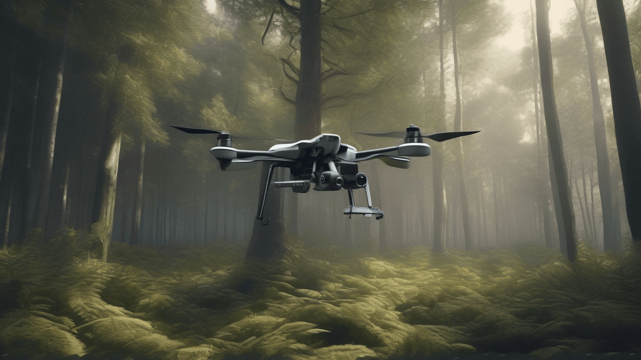
 Figure 1: A drone navigates a complex scene, its camera capturing the raw visual data that ReCoSplat transforms into a detailed 3D map.
ReCoSplat's Secret Sauce: Autoregressive & Render-and-Compare
ReCoSplat tackles these challenges head-on with a clever combination of techniques. At its core, it's an autoregressive Gaussian Splatting model. This means it doesn't try to build the entire map all at once. Instead, it builds it incrementally, frame by frame, continuously refining and expanding its understanding of the environment as new camera data comes in. Think of it like a sculptor who adds a little bit of clay with each passing moment, constantly shaping and detailing their work.
Here's a closer look at what makes ReCoSplat tick:
Building on the Fly: Autoregressive Feed-Forward Processing
Unlike many traditional methods that might re-optimize the entire scene with every new frame, ReCoSplat operates in a feed-forward manner. It processes each new camera frame sequentially, updating the 3D map without needing to revisit past frames extensively. This is crucial for real-time performance on resource-constrained drone hardware. It's a continuous learning process, always moving forward.
The "Render-and-Compare" Loop
One of ReCoSplat's most ingenious components is its "Render-and-Compare" mechanism. When a new camera frame arrives, the system doesn't immediately try to add new splats. Instead, it first renders a prediction of what the current scene should look like from the drone's estimated current camera position, using the existing 3D map (its collection of Gaussian splats).
Then, it compares this rendered prediction with the actual new camera frame. The differences between the prediction and the reality provide valuable feedback. This comparison helps ReCoSplat do two critical things:
- Refine Camera Pose: By minimizing the discrepancies, the model can more accurately estimate the drone's precise camera position and orientation for that frame, even if the initial sensor data was noisy or uncertain. This is vital for "unposed" camera feeds, where exact camera locations aren't known beforehand.
- Update the 3D Map: The comparison also highlights areas where the existing 3D map is incomplete or inaccurate. New Gaussian splats can be added to fill in gaps, existing splats can be refined (their color, size, or transparency adjusted), or redundant splats can be removed. This ensures the map stays detailed and up-to-date.
This continuous loop of predicting, observing, and correcting allows ReCoSplat to robustly build and maintain a high-fidelity 3D map, adapting to the drone's movements and the evolving environment.
Taming Memory for Long Journeys
A common pitfall for incremental 3D reconstruction systems is memory consumption. As a drone explores a larger area, the 3D map can grow exponentially, quickly overwhelming onboard memory. ReCoSplat addresses this with smart memory management strategies. While the paper doesn't detail these specifics in the excerpt, such systems typically employ techniques like culling (removing splats that are no longer visible or relevant), merging similar splats, or using hierarchical representations to keep the memory footprint manageable, even over extended mapping missions. This ensures the drone can map vast environments without running out of digital space.
 Figure 2: A dense cloud of Gaussian splats accurately reconstructs an environment, showcasing the level of detail achievable even from challenging drone footage.
Putting it to Work: Real-World Impact
The implications of ReCoSplat are significant for any application requiring real-time, high-fidelity 3D understanding from mobile platforms.
- Autonomous Navigation: Drones could navigate more complex environments, avoiding obstacles and finding optimal paths with greater precision, even in GPS-denied areas like dense forests or urban canyons.
- Inspection and Monitoring: From checking power lines and wind turbines to surveying construction sites,
ReCoSplatcould enable drones to generate immediate, detailed 3D models for damage assessment or progress tracking, reducing the need for time-consuming manual analysis. - Search and Rescue: In disaster zones or remote areas, drones equipped with
ReCoSplatcould rapidly map terrain and structures, providing rescuers with crucial spatial information in real-time, potentially saving lives. - Environmental Science: Researchers could use drones to quickly map vegetation, geological formations, or animal habitats in 3D, gaining new insights into ecosystems without extensive fieldwork.
The ability to build robust 3D maps from "wobbly vision" opens up a new frontier for drone autonomy and utility, pushing them beyond simple aerial photography into sophisticated spatial intelligence.
 Figure 3: A side-by-side comparison demonstrating ReCoSplat's ability to accurately reconstruct a scene, even from a noisy input frame.
The Road Ahead: Where ReCoSplat Shines (and Stumbles)
While ReCoSplat represents a substantial step forward, like any cutting-edge technology, it comes with its own set of considerations and areas for future development. Understanding these limitations is key to appreciating its current capabilities and guiding future improvements.
- Computational Demands: Despite its efficiency claims, real-time Gaussian Splatting, especially with continuous refinement and pose estimation, can still be computationally intensive. Running
ReCoSplatentirely on a drone's limited onboard processor might require specialized hardware (like powerful GPUs) or careful optimization, potentially limiting its deployment on smaller, more cost-effective platforms. - Dynamic Environments:
ReCoSplatexcels at mapping static or slowly changing scenes. However, highly dynamic environments with fast-moving objects (e.g., dense crowds, rapidly changing foliage in strong wind, other vehicles) could pose a challenge. The autoregressive update mechanism might struggle to keep up with rapid scene changes, potentially leading to ghosting artifacts or inaccuracies in the map. - Generalization to Novel Textures/Lighting: While robust, the quality of the reconstructed map can still be influenced by the visual characteristics of the environment. Extremely repetitive textures, highly reflective surfaces, or drastic changes in lighting conditions (e.g., moving from bright sunlight to deep shadow) might introduce ambiguities that challenge the "Render-and-Compare" mechanism, potentially leading to less accurate pose estimation or map fidelity in those specific scenarios.
These points highlight that while ReCoSplat significantly pushes the boundaries of real-time 3D mapping for drones, there's always room for further innovation to make these systems even more robust, efficient, and universally applicable across an even wider range of challenging scenarios.
Paper Details
ORIGINAL PAPER: ReCoSplat: Autoregressive Feed-Forward Gaussian Splatting Using Render-and-Compare (https://arxiv.org/abs/2403.09968) RELATED PAPERS: BEACON: Language-Conditioned Navigation Affordance Prediction under Occlusion, From Semantics to Pixels: Coarse-to-Fine Masked Autoencoders for Hierarchical Visual Understanding, Efficient, Adaptive Near-Field Beam Training based on Linear Bandit FIGURES AVAILABLE: 10
Written by
The Flight DeskSharing knowledge about drones and aerial technology.